Government is a Racket
Following some investigative work into Census Bureau contracts it was discovered that among others, Michael Baker Jr. Corporation was given a $10 million contract for data collections services that involve Global Positioning System (GPS) technology.
Excerpts from an article titled, "Baker Firm Lands Census GPS Work"
"The contract calls on Baker to serve as project manager and provide GPS coordinate data points to validate the spatial accuracy of the division's Topologically Integrated Geographic Encoding and Referencing (TIGER) system. The project encompasses data collection in nearly 1,200 counties throughout the United States. Baker officials expect that the project will require more than three years of fieldwork and data analysis."
"A focus on validation and accuracy of GPS data points is expected to play a key role in the bureau's plan to modernize data-management for the 2010 census. In a budget initiative statement for the 2003 fiscal year, Preston Jay Waite, associate director for de-cennial census, said that an updated master address file (MAF) and an accompanying improved TIGER database, with GPS positional accuracy, would be a key part of a census re-engineering."
In the course of researching the Shadow Government - the regional organizations that lurk in the shadows and who direct the activities of the ballot box puppets, it was discovered that the Federal Emergency Management Agency (FEMA) has a map modernization project that you - the taxpayers are paying for via the Department of Homescam Security / FEMA budget. One of the purposes for the map modernization project is for the National Flood Insurance Program. Michael J. Baker Jr. Corporation is the project manager for the map modernization project: MAPMOD:
Michael Baker Jr., Inc., an engineering
unit of Michael Baker Corporation (NYSE Alternext US: BKR), is the
recipient of an Honor Award from the American Council of Engineering
Companies of Metropolitan Washington (ACEC/MW) in the 2008-2009 ACEC/MW
Engineering Excellence Awards Competition for their work on the National
Flood Hazard Layer (NFHL). Baker developed and deployed the NFHL under
contract to the Federal Emergency Management Agency (FEMA). [NFHL
is the Flood Hazard Layer of the TIGER System].
Arkansas Geographic Information
Arkansas GIS Gateway: "Michael Baker Corporation, out of Denton, TX, is the Project Manager for the MapMOD Program in Arkansas. They have made availiable several brochures from FEMA that offers great insights into the MapMOD Program and information about a community becomming a Cooperating Technical Partner (CTP) with FEMA."
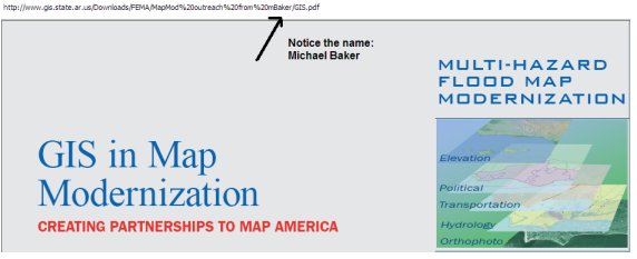
MAPMOD Project (Notice the name at the bottom of the page) - emphasis added
Flood Map Modernization Program
The Department of Homeland Security’s Federal Emergency Management Agency (FEMA), as the agency responsible for administration of the National Flood Insurance Program (NFIP), conducts flood hazard studies and prepares flood maps.
Flood Map Modernization (Map Mod) is FEMA’s multi-year effort to update the Nation’s flood maps and present the map data in a digital environment thereby transforming the flood maps into a more reliable, easier-to-use, and readily available product.
As part of Map Mod, FEMA has established a partnership with a National Service Provider, known as the Mapping on Demand (MOD) team. The mission of the MOD team is to assist FEMA in meeting Map Mod’s goals. The MOD team Regional Management Centers (RMCs) are co-located with the FEMA Regions and collaborate with them on a daily basis to reach these goals, by helping FEMA:
- Develop technology to facilitate the cost-effective production, distribution, and usefulness of modernized flood maps
- Provide effective program management to efficiently run Map Mod and meet the mandates established by Congress for budget and schedule
- Empower the user community to understand and accept the products developed by Map Mod
- Encourage and enable partners to deliver results by taking ownership of flood mapping process and products, effectively using the standard tools and technology available nationwide
FEMA - Map Modernization Project
So tax dollars pay to build the systems, collect the data, and then the information collected is sold. And, that's not all - the taxpayers pay to build the systems and collect the data through every agency that uses the same information. I call that a racket.
The re-engineered 2010 Census consists of three highly integrated activities...
The three integrated components are:
1. Collect and tabulate long-form data every year throughout the decade through a large household survey (The American Community Survey).
2. Enhance and improve our existing address lists and GIS database (TIGER) system by bringing them into alignment with true GPS coordinates and converting our TIGER to a COTS database environment.
3. A program of early planning, development and testing designed to completely restructure the management and conduct of a short-form-only census in 2010. That will further reduce the differential undercount measured since the 1940s without resorting to statistical adjustment and will provide the savings needed to support this initiative.
An updated master address file (MAF) and an accompanying improved TIGER database, with GPS positional accuracy, will allow the Census Bureau to maintain the inventory and location of addresses and features. In addition, we will greatly expand our ability to improve the accuracy and completeness of our census GIS systems that process these data. These MAF/TIGER enhancements are key to allowing the Census Bureau to adopt the technology necessary to fully utilize GPS-equipped, hand-held mobile computing devices to find, interview and update data on persons and housing units for the short-form-only census in 2010 thereby, achieving the Census Bureau's constitutionally mandated objectives at a greatly reduced cost.
In the president's budget we are requesting $218.9 million in Fiscal Year 2003 for this re-engineering effort.
The following is an excerpt from the Prepared Statement of Charles Louis Kincannon, Director of the U.S. Census Bureau for a Congressional Hearing on March 1, 2006 that was posted as a press release on the Census Bureau website (emphasis added):
Good morning. On behalf of the U.S. Census Bureau, I want to thank Chairman Turner and the Subcommittee on Federalism and the Census for inviting me to testify on the progress of the 2010 Decennial Census Program. Today, we are four years and one month from Census Day. Because of your support, many of the key planning and operational components of the 2010 reengineered census are already underway, including the fully-implemented American Community Survey; the address list and map, known as MAF/TIGER, consolidation and modernization; and the 2010 Census testing and preparation activities.1 Each of these components is an integral part of a successful 2010 Decennial Census Program.
The success of the decennial census is the Census Bureau’s largest priority, and represents sixty percent of the President’s FY2007 budget request for the Census Bureau. This request includes approximately $184 million for salaries and expenses, as well as $182 million for other economic and demographic programs conducted by the Census Bureau. The budget request of $512 million, an increase of $64 million from last year, for the Decennial Census Program includes $180 million for the American Community Survey; $74 million for MAF/TIGER; and $258 million for 2010 Census activities.
The American Community Survey, the nation’s largest continuous household survey, is crucial to the overall success of the decennial census because it replaces the long form. This will allow the Census Bureau to conduct a short-form only census and fully focus its efforts on the constitutional responsibility of the census—an accurate, complete enumeration. The American Community Survey also provides annual, up-to-date estimates for the characteristics of the population. Because of strong congressional support, the American Community Survey is on track and moving toward its goals. The American Community Survey began full implementation in 2005, when the survey’s sample size reached three million housing units per year, or about 250,000 housing units per month. We have been able to maintain high response rates throughout the survey. In January 2006, we began the last phase of full implementation by incorporating group quarters data collection in the survey.
The American Community Survey is important to the nation, because it strengthens the nation’s data infrastructure by providing timely local data that will enhance decision-making at all levels of government, as well as the private sector.
The Census Bureau is conducting an extensive, nation-wide operation to modernize and consolidate MAF/TIGER. We are using GPS to align streets of the TIGER maps and working with communities to ensure we do not miss a new neighborhood. These objectives are supported by the 2007 budget request for $74 million for the MAF/TIGER Enhancement Program. To date, working with the Harris Corporation, we have realigned the streets and roads for approximately 1,700 of the nation’s counties, with about 1,600 more to go in order to reach completion by April 2008. This improvement is significant because the TIGER system and census data are national resources used by both the public and private sectors to make decisions affecting the quality of life throughout the United States. TIGER is used by the US Geological Survey (USGS) for the National Map, as well as commercial applications.
With this information, whoever has a copy of the TIGER database will be able to enter your address and find out just about everything about you - what assets you have - or don't have, what the demographics of the neighborhood are ("this is a rich neighborhood, they can afford a big tax increase in the value of their homes"; "this is a poor neighborhood, we could improve our economic position if we ran them out of there"), etc.
Prediction for the 2020 Census
The Nationalized Medical Records System will be fully implemented and a new layer of health information will be added to the TIGER database. The CMS and CDC will partner with the Census Bureau to design a new section in the American Community Survey. Rumor has it that in addition to all the other data collected, the census taker's, they will be required to count the pimples on your butt. This information will be useful to the CDC for their Butt Pimple Eradication Program. But this is all speculation at this point. We'll have to wait and see what happens. But in the meantime, you might want to start practicing saying, "NONE OF YOUR BUSINESS" to the Census Bureau for anything other than the number of persons living in your home and their names.
Vicky Davis
May 31, 2009
Related stories:
Big Brother at your Front Door
GPS Census Alert! Alert! Alert!